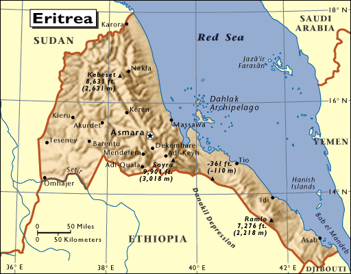
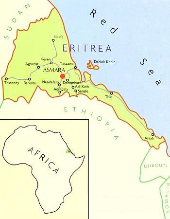
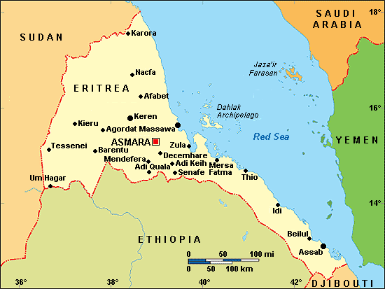
Map of Eritrea
Location and geography
Eritrean history
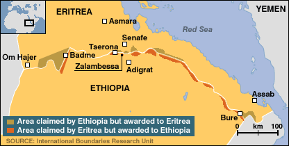
Border conflict with Ethiopia
Political structure
Eritrean anthem
Economy & currency
Climate
People
Languages
Religion
Health care
Transport
Cuisine
News, links, books and more
Asmara (Asmera)
Agordat (Akordat)
Assab (Asseb)
Barentu
Dahlak islands
Dekemhare (Decemhare)
Ghinda (Ginda)
Keren (Cheren)
Massawa (Massauwa)
Mendefera (Adi Ugri)
Nakfa (Nacfa)
Semenawi Bahri (Filfil)
Tessenei
(Teseney)
Eritrea maps
Eritrea, places of historical interest map (Lonely Planet)
Eritrea, rivers & elevation map
Eritrea administrative regions map
Eritrea in East African perspective
Eritrea photographed from space
Full map of the decisions of the Eritrea Ethiopia Boundary Commission
Eritrea and Northern Ethiopia (Shaded relief map, 1999, 321K)
Political map of Ethiopia (1970) showing Eritrea as an Ethiopian province
Eritrea primary routes map (http://www.erythree.com)
Worldatlas.com maps of Eritrea
Maps of the Eritrean cities Asmara (orientation and city center), Massawa (orientation and islands), Keren and Assab, as well as the villages Adi Keyih, Adi Quala, Afabet, Agordat, Barentu, Dekemhare, Mendefera, Nacfa and Senafe can be found in the book Eritrea, The Bradt Travel Guide.
International Travel Maps publish a good map of Eritrea, which also shows a map of the Eritrean capital Asmara.