Map of Eritrea
Location and geography
Eritrean history
Border conflict with Ethiopia
Political structure
Eritrean anthem
Economy & currency
Climate
People
Languages
Religion
Health care
Transport
Cuisine
News, links, books and more
Asmara (Asmera)
Agordat (Akordat)
Assab (Asseb)
Barentu
Dahlak islands
Dekemhare (Decemhare)
Ghinda (Ginda)
Keren (Cheren)
Massawa (Massauwa)
Mendefera (Adi Ugri)
Nakfa (Nacfa)
Semenawi Bahri (Filfil)
Tessenei
(Teseney)
Tessenei Eritrea
Tessenei is located 45 kilometer from the Sudanese border and approximately 115 kilometers beyond Barentu. Tessenei is a population center for the western area, a frontier town with about 18,000 people from various ethnic backgrounds. The market place buzzes with nomadic traders, Tigrayan merchants and returnees from Sudan. The main square in front of the mosque is abuzz with many kinds of different trade, including tailors, cafés, bars and other shops.
There is a busy exchange market where the Saudi Rial and the Sudanese Pound are exchanged to Eritrean Nakfa's and the food in the 'souk' area has a distinctly Sudanese flavor. Tessenei is one of the reception points for returnees from the refugee camps in the Sudan who then proceed to other locations.
On the outskirts of Tessenei to the north are a couple of hills from which there are exceptional views of the lowlands and the mountains inside Sudan. 10 kilometers to the west of the city is the Barattolo cotton plantation at Adi Ghider where Hedareb tribes and 1500 ex-fighters and their families farm cotton, sesame and sorghum. Adi Ghider is an old Italian frontier village, still containing a few Italian relics, but the village was extensively sacked by the Ethiopian forces in 2001 in their campaign to sabotage the Eritrean economy.
Tessenei itself was liberated in 1988, having suffered extensive damage during the was of liberation (1961 -1991). Outside Tessenei just beyond Haykota, is a monument to Idirs Awate. He fired the first shots in the liberation struggle in September 1961.
During the rainy season (July to September) most areas around Tessenei are impassable, but the recently constructed asphalt road from Barentu to Tessenei guarantees a comfortable trip by road to this border village. Daily buses leave to both Kasala in Sudan, Barentu and Asmara, the Eritrean capital.
| Resume of hotel accommodation in Tessenei | ||||
| Name | Address | Rooms | Phone | Fax |
| Barka | near bus station | 721 203 | ||
| Hade Africa | 721 067 | |||
| Keren | near bus station | 721 204 | ||
| Lewhat | 721 211 | |||
| Luna (recommended) | near new telecom | |||
| Warsa | 721 124 | |||
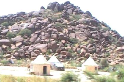
Traditional dwellings in Tesseney, Eritrea.
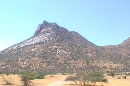
The beautiful landscape around Tesseney.
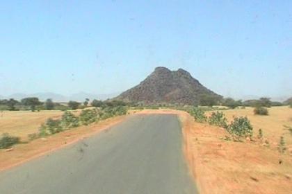
New road to Tesseney.
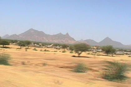
The landscape around Tesseney.
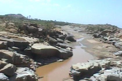
Banks of the Gash river passing Tesseney.
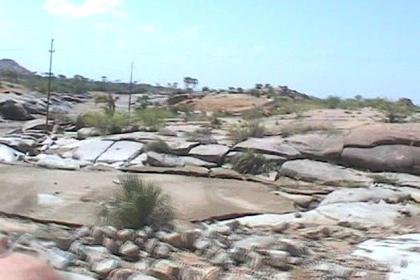
Rough landscape around Tesseney.
More pictures of Tesseney Eritrea > > >