Map of Eritrea
Location and geography
Eritrean history
Border conflict with Ethiopia
Political structure
Eritrean anthem
Economy & currency
Climate
People
Languages
Religion
Health care
Transport
Cuisine
News, links, books and more
Asmara (Asmera)
Agordat (Akordat)
Assab (Asseb)
Barentu
Dahlak islands
Dekemhare (Decemhare)
Ghinda (Ginda)
Keren (Cheren)
Massawa (Massauwa)
Mendefera (Adi Ugri)
Nakfa (Nacfa)
Semenawi Bahri (Filfil)
Tessenei
(Teseney)
Dankalia
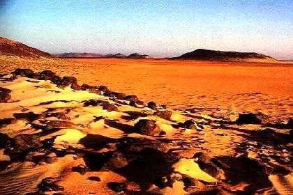
Dankalia is one of the most inhospitable areas on earth. It is for the most part poor of fauna and flora and presents alternately desert flatlands and isolated mountain groups, sometimes interrupted by valleys spotted by thorny acacias. Green oasis of dum-palm trees interrupt the desert landscape in the zones of Beylul, Assab and Rahaita.
More inland, toward the Ethiopian highland, a long depression extends itself reaching a depth of 120 meters below the sea level. This part of Eritrea is one of the lowest and hottest places on earth and is known as Dallol (Danakil depression), where temperatures can reach 145°F (50° C) in the sun.
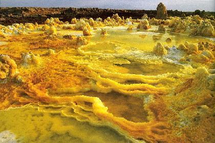
The Danakil depression is an area along the Great Rift where the earth's crust has stretched and thinned and the land has sunk over time to 371 feet below sea level, one of the lowest points on earth's surface. Here the earth's crust is thin enough that new land surface is constantly being created by new lava that oozes upward. Water also seeps down, to be ejected again as steam. volcanic cones are common sights, as are deep cracks in the earth. Hundreds of small earthquakes convulse the area every year.
10.000 years ago the Danakil desert was part of the Red Sea when the earth's crust collapsed and water flooded in. Volcanic eruptions brought about dykes of basaltic rocks which trapped the water. In the southern Danakil region, which is of volcanic origin, there are numerous lava flows which lay among the numberless cones distinctly truncated at their tops. Subjected to a blazing sun, the inland sea gradually evaporated. Enormous salt flats and very salty lakes are the last remains of that long process. For many Afar tribes living in the area, salt mining is still a major source of income.
There is no rain for three-quarters of the year, and what water does flow down from the highlands vanishes into shallow saline lakes. The wind, when it does blow, is too dry and scorching to bring any relief.
The Afar
Living in this waste of crumbling rock and broken lava flows are a people as tough and often as hostile as their environment: The Afar.
The Afar people are largely nomads and almost entirely Muslim by faith. The four major sultanates and numerous sheikhdoms are spread over three countries: 300,000 Afar live in Eritrea, 1,000,000 in Ethiopia, and 300,000 in Djibouti. The Afar language (or Danakil) is a Cushitic language.
Most are herdsmen, tending goats and camels, the essential beast of burden for these nomadic people. Some Afar in more favored areas, tend cattle. Those with goats and camels migrate long distances in search of scanty herbage; the cattle owners remain for the most part in specific grazing areas. Afars near the coast are, on the other hand, expert fishermen. Many Afars have long been engaged in the mining of rock salt, with which they trade with the highland interior.
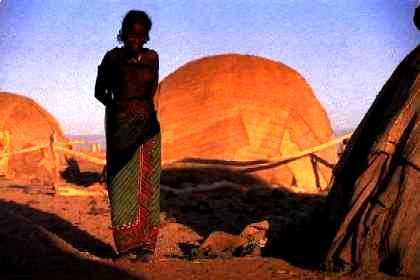
Afar huts, called aris, provide shade from the sun, and storage for their owners' scanty possessions, are hemispherical in shape and made of palm ribs covered with matting. Light enough to be transported on camel-back, they are erected in semi-permanent locations in the course of seasonal migrations, usually near wells.
The diet of the Afar people consists chiefly of fish, meat, sour milk and porridge made from dura flour, and heavy round pancakes made of wheat topped with red pepper and a sauce of clarified butter called ghee. Milk is so important to the afar that it is also used as a social offering, given to visitors to establish a proper guest-host relationship.
Food must only be eaten with the right hand. The left hand is used for impure purposes. To use it for food, accepting a present, or for shaking hands, is an insult. The Afar also drink an intoxicating potion made from the dum palm.
The Afar people generally live in isolation. The clan, a group of extended families, is the most important political and social unit of Afar culture. Descent is traced through the male line, and it is said that Afar men inherit strength of character from their fathers. Physical characteristics such as height, and also spiritual aspects are said to come from the mother.
The Afar are an independent-minded people, and one who lay great stress on a man's toughness, strength and bravery. Weaklings do not survive in the Danakil Desert.
In the past, a further requirement for achieving manhood was to kill a male member of an enemy tribe and castrate the victim. The young Afar man was then looked upon with respect and entitled to certain rights, such as marriage.
The Afar Coast with volcanic activity.
Light and portable, the Afar huts (or ari) provide shade from the blistering
sun and storage for their owners' meager possessions. The Afar house
is hemispherical in shape and made of palm ribs covered with matting.
It can be built and dismantled quickly, a job usually reserved for women.
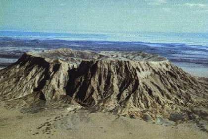
Guyot as seen from the air.
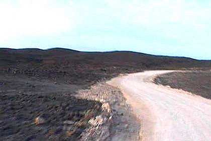
The road to Assab.
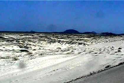
Blue skies, black mountains, white sand - Danakil Desert.
Weird volcanic landscape - Remote dwelling - Danakil Depression.
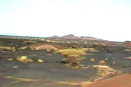
Scattered vegetation in lava fields.
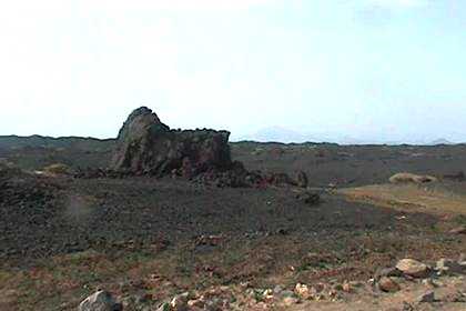
Lava structures in the Danakil Desert.
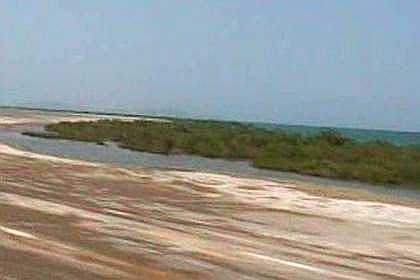
Salt and mangrove forest on the Red Sea coast.
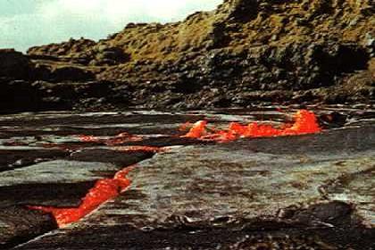
Erta Ale lava lake (Danakil Depression).
The Great Rift Valley was formed by a ripping motion when large land masses pulled apart. Around 40 million years B.C. the eastern coast of Africa experienced violent change and pulled away from the rest of the continent. It left behind a very long, steep-sided valley filled with volcanos. The valley filled with a huge inland sea which drained and refilled several times over thousands of years.
Stretching from the Red Sea coast of Eritrea through the mountains of Ethiopia, Uganda, Kenya and Tanzania, the Great Rift Valley finally ends in southeast Africa in Mozambique. It is named the Great Rift because it is the longest rift valley in the world.