Map of Eritrea
Location and geography
Eritrean history
Border conflict with Ethiopia
Political structure
Eritrean anthem
Economy & currency
Climate
People
Languages
Religion
Health care
Transport
Cuisine
News, links, books and more
Asmara (Asmera)
Agordat (Akordat)
Assab (Asseb)
Barentu
Dahlak islands
Dekemhare (Decemhare)
Ghinda (Ginda)
Keren (Cheren)
Massawa (Massauwa)
Mendefera (Adi Ugri)
Nakfa (Nacfa)
Semenawi Bahri (Filfil)
Tessenei
(Teseney)
Gash Barka Eritrea
With an area of 37,000 square kilometers and a population of 600,000, the Gash Barka region makes up roughly one-third of Eritrea. Two seasonal rivers, the Gash which marks a geographical border between Eritrea and Ethiopia and the Barka river, cross the region.
Gash Barka is one of the richest zones in ethnic diversity: all except one of Eritrea's nationalities inhabit this zone: Kunama, Nara, Hedareb, Tigre, Tigrinya, Saho, Bilen and Rashaida live in this region. Barentu, Agordat en Tessenei are its largest towns. Barentu hosts the regional administration.
The Gash Barka region is part of the Sudano-Sahelian agroclimatic zone and it is said to be the breadbasket of Eritrea. The region is very rich in agriculture. A variety of crops, fruits and vegetables grow in in the Gash Barka region, including millet, sesame, cotton, banana, tomato, onions, green pepper, sweet melon etc. The soil is very fertile. There are over 3.5 million livestock in the region. There is also a large expanse of land covered with gum Arabic.
Also, the region is rich in different kinds of marbles and has very high mineral prospects including gold. In Augaro there are some old mineshafts and machinery from the days when the Italians mined gold here.
The economic value of the region is one of the obvious reasons why famine wrecked neighbor Ethiopia, ruled by the separatist TPLF regime, occupied the region during the 1997-2000 war. During this invasion the TPLF regime killed many innocent people while destroying and looting public and private properties and livestock.
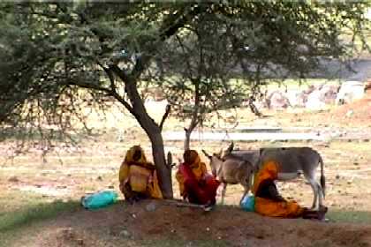
Women resting in the shade of a tree near Agordat.
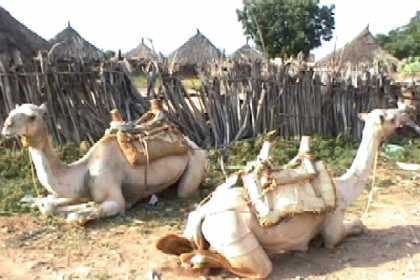
Camels resting in the sun in Agordat.
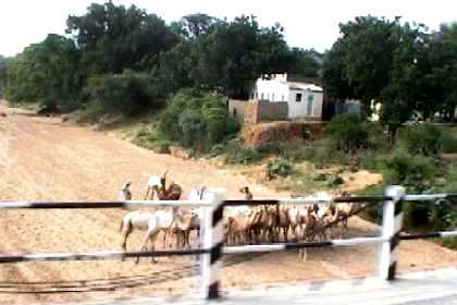
Dry riverbed crossing the Barentu - Agordat road.
The Barka river passing Agordat (dry season).
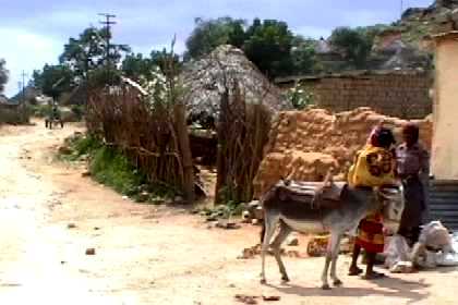
Image of Barentu in the heart of the Kunama territory.